Rain Alert Today: Heavy rainfall has cast a shadow over northern and western India. From Delhi to Mumbai and across six major states, relentless downpours have disrupted daily life. The India Meteorological Department (IMD) has issued a red alert for heavy rainfall in multiple regions. Monsoon activity has intensified, stretching from the Himalayan states down to the coastal belts, affecting urban centres and rural areas alike.
Also, Follow Today’s Weather News LIVE Update
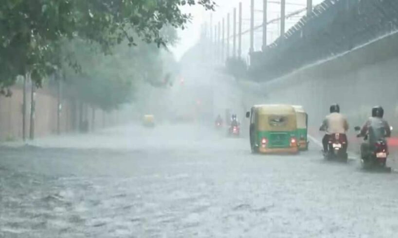
Often burdened by erratic monsoon patterns, Delhi and National Capital Region (NCR) witnessed continuous rainfall on Monday. The city’s roads turned into water channels. Noida, Gurugram and Delhi saw massive traffic jams. Commuters remained stranded for hours. Water logging disrupted office routes and emergency services.
Add Zee News as a Preferred Source
The IMD forecast signals no immediate relief. Intermittent rain is expected to continue in Delhi until September 5. Experts attributed the rainfall to an active monsoon phase combined with an unusually strong western disturbance. This weather pattern has led to intense rainfall in the Himalayan belt and continues to influence the plains.
Temperatures in Delhi have dropped. Monday’s maximum was recorded at 30.8°C, nearly 4 degrees below normal. The minimum fell to 23.7°C, also lower than average. On Tuesday, the mercury is expected to hover around 31°C during the day and 22°C at night.
In Himachal Pradesh and Uttarakhand, the weather has turned treacherous. Red alerts have been issued for southern Himachal districts, while orange alerts cover parts of Uttarakhand. Landslides and sudden river swelling remain major concerns.
In the past 24 hours, over 21 cm of rain was recorded in Himachal, Uttarakhand, Punjab, parts of western Rajasthan and Telangana. Heavy to very heavy rainfall has also been observed in Haryana, Chandigarh, Uttar Pradesh and eastern Rajasthan.
In western India, the situation remains critical. The IMD forecasts persistent rain from September 3 to 6 in Gujarat, Konkan-Goa, coastal Karnataka and Madhya Maharashtra. On September 4 and 5, extremely heavy rainfall may impact normal life in Saurashtra-Kutch and hilly interiors.
Chhattisgarh, Vidarbha and western Madhya Pradesh are also under rainfall advisories for the same period.
A new low-pressure system is expected to form in the Bay of Bengal. Cyclonic circulation and a pronounced trough line are likely to extend from Rajasthan to Odisha-Jharkhand. These systems are expected to widen the zone of impact further, spreading the intensity of rainfall to new areas.
In the northeast, states such as Assam, Meghalaya, Nagaland, Manipur, Mizoram and Tripura are set to receive consistent heavy rainfall starting September 2. Widespread showers are predicted across Odisha, Chhattisgarh, Vidarbha and West Bengal.
Authorities remain on high alert. With the threat of flash floods, landslides, waterlogging and low visibility on roads, people are urged to stay cautious. The IMD has advised citizens to avoid unnecessary travel. Low-lying areas and vulnerable hillsides should be approached with care. Weak infrastructure, muddy trails and standing crops may face severe damage.
The IMD has stressed the importance of keeping track of local updates and advisories. Staying informed and alert is key. The monsoon, while necessary for agriculture, continues to challenge urban infrastructure and disaster preparedness. This round of rainfall may intensify before relief appears on the horizon.