Overlooking the five-acre property Julie Bond has called home for the past 33 years, she reflects on the droughts, cyclones, and hailstorms that have passed over her land.
Despite the erratic Queensland weather, Ms Bond says her Logan Village property has remained almost unscathed by the elements for over three decades.
A council-owned water easement runs through her back paddock to ensure rainwater easily passes over her property, and the retiree says flood waters have never come close to reaching her dwellings on a hill.
“The land slops downward … [the water] just flows through the back.
“In saying that [the water] is only between ankle and not even knee height.”
In 2022, the water easement on Ms Bond’s property flooded, but she says the water was not deep. (Supplied: Julie Bond)
For that reason, Ms Bond said she was shocked to learn Logan City Council had marked half of her property as at ‘high risk’ of flooding and with a ‘history of being inundated’.
She is one of many south-east Queenslanders unsatisfied with new flood mapping put forward by their local councils.
“I just object to something being that high when I know the levels have never, ever been that high in 33 years,” she said.
“The water easement is there for a reason … that’s where the water flows.”
Insurance cost concerns
The flood map changes formed part of the updated draft Logan Plan and mapped up to a one-in-2000 annual chance flood event, or a 0.05 per cent chance of happening each year.
Mayor Jon Raven said the council was also required to map to a Probable Maximum Flood (PMF) scenario.
“It’s a flood that we never think will happen, but because it’s required of us in the State Planning Policy, that’s what we’ve mapped out to,” he said.
Cr Raven has criticised insurers for increasing prices in response to flood maps. (ABC News: Lucy Loram)
The State Planning Policy gives local councils the ability to determine the appropriate planning controls for development in flood-prone areas.
Deputy Premier Jarrod Blejie said he had met with Cr Raven to “fix” the draft flood maps.
“The Crisafulli Government is currently reviewing the State Planning Policy which guides flood risk assessments to ensure property rights are maintained, and better planning outcomes are achieved,” he said in a statement.
Dreading the effect the ‘high’ flood risk would have on her insurance bill, Ms Bond began shopping around for quotes.
“It’s ridiculous. We’re retirees. So, we’re living off our super. Who can afford to pay $10,500 a year for insurance?” she said.
Ms Bond has had to shop around for cheaper insurance options after flood mapping earmarked her property as at-risk of flooding. (ABC News: Lucy Loram)
“I would say it’s affected our mental health because this is not something we expected to be dealing with at this stage in our lives … we should be kicking our feet up.”
Cr Raven said the issue laid with the insurers.
“Insurance companies are doing the wrong thing in my opinion … I think that’s predatory pricing,” he said.
A spokesperson for the Insurance Council of Australia said insurance companies rely on a lot more than the local council flood maps when calculating premiums.
Why is flood mapping different between Queensland local councils?
“Each insurer uses their own unique, sophisticated datasets and risk assessment capabilities beyond local council flood maps, with most insurers calculating premiums at an address level based on risk exposure,” the spokesperson said in a statement.
“The Insurance Council has long advocated for greater investment in resilience and mitigation and is engaging with all levels of government on the solutions required to safeguard our most at-risk communities.”
Submissions closing
West of Logan, the Ipswich City Council implemented changes to flood mapping in July after a period of community consultation.
Phil Brooks says he’s never had overland flow on his property, yet it has now been identified as at risk. (ABC News: Tobi Loftus)
Bundamba resident Phillip Brooks is not satisfied with the mapping that placed his property as at risk of overland flooding.
“I’ve been here since 1995 and we’ve never had overland flow on this property,” he said.
“This is going to cost me significant amounts of money because I was planning to downsize — I’m getting quite old now — and build a smaller, environmentally friendly, sustainable house on the land that was here.”
Flood mapping that identified an overland flood risk on Mr Brooks’ property has prevented him from being able to sub divide. (ABC News: Tobi Loftus)
Mr Brooks said the new report prevents him from subdividing his property, dampening his plans to sell his current home and downsize.
Ipswich Council’s chair of the Infrastructure, Planning, and Assets Committee Andrew Antoniolli said residents with concerns about how the flood mapping impacted their property were encouraged to contact the council.
“Council remains committed to the ongoing improvement and refinement of its flood mapping based on any new evidence that comes to light,” Cr Antoniolli said in a statement.
“This code is not designed to deter development in Ipswich, rather it puts in place the framework to encourage residential development in the right areas and imposes requirements on developers to mitigate flood impacts as much as possible.
“The evidence is clear that as our climate is changing, Ipswich is likely to endure flooding in the future worse than we have before — and flood mapping included in Ipswich City Plan 2025 reflects this.”
In Logan, residents have until the end of the month to provide feedback on flood mapping, including the impact on insurance premiums.
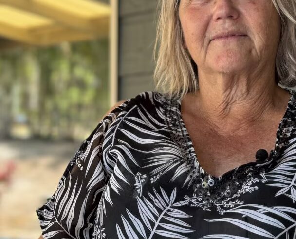
Julie Bond says she would like to see the Logan council undertake individual site inspections. (ABC News: Lucy Loram)
Ms Bond said she hoped the local council would follow up on her concerns.
“I think the only way they can prove they have taken it on board is if they go and do individual site inspections to verify their dataset and reduce the maps to reflect landholders’ mitigation that they’ve done as well for storm water,” she said.