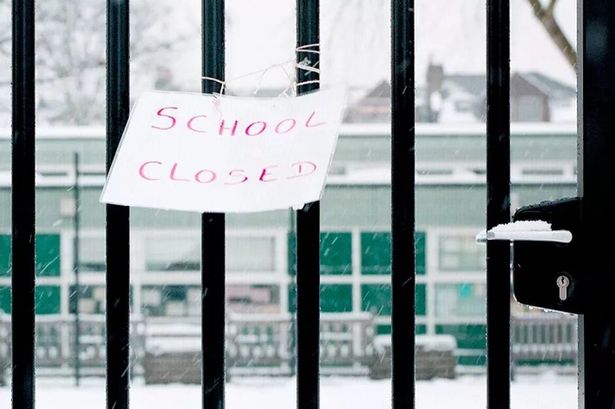
Certain requirements have to be met during a low temperature warning for schools to close
Schools have been urged to err on the side of caution
Following Met Eireann’s latest weather warnings, many people will be wondering if schools will close.
Met Eireann have placed a Yellow Low Temperature Warning has been placed on Carlow, Kildare, Kilkenny, Laois, Longford, Meath, Offaly, Westmeath, Wicklow and Tipperary.
They also issued a Yellow Snow and Ice warning for Cavan, Donegal, Monaghan, Leitrim, Sligo from midnight last night until 12PM today.
And the UK Met Office issued a similar yellow alert for Antrim, Armagh, Down, Fermanagh, Tyrone, Derry from 5pm today until 1pm Thursday.
The Department of Education and Youth have said that when it comes to school closures the final decision rests with individual management, reports the Irish Sun.
They have advised that those in charge should “err on the side of caution.”
A spokesperson said: “All schools should keep up to date with the current weather warnings, which are carried on all national and local news bulletins, and particularly any change in the status warning for their area.
“The decision to close a school rests with the school management authority, taking into consideration the full guidance and direction available from the principal response agencies.
“In all events, and if in any doubt, schools should err on the side of caution. Schools are empowered to make closure decisions if, in their judgment, in the interests of the safety of the school community, it is prudent to do so.”
“Primary and post-primary schools in areas affected by a weather warning should remain vigilant and keep themselves apprised of any hourly and other updates from Met Eireann, and from their local authorities, local radio, and the principal response agencies.”
Met Eireann’s latest forecast shows unsettled weather as we head for the weekend.
Thursday
A very cold but mostly dry start this morning apart from a few showers dying out over Connacht and Ulster.
Crisp sunshine will break through this morning with plenty of clear and dry weather for this afternoon and evening. Rather chilly though with highs struggling at 3 to 7 degrees in a cold northerly breeze.
Thursday night: A largely dry and clear night in store but turning very cold too with temperatures falling 0 to -3 degrees leading to some frost and icy stretches.
Friday
A mostly dry start but becoming quite cloudy later in the morning with outbreaks of rain developing along Atlantic coastal counties in a freshening southwesterly breeze. Highest temperatures of 5 to 9 degrees.
Friday night: Rather cloudy then Friday evening with a freshening southwesterly breeze. Rain and drizzle along Atlantic coastal counites will gradually spread through the country overnight.
The rain will be heavy at times too particularly in the west. Lowest temperatures of 1 to 4 degrees.
Saturday
Wet, cloudy and unsettled to start with rain slowly clearing to the east by late morning. There will be a good deal of dry weather developing for the afternoon however it will remain overcast.
Showers which could be heavy at times will push in across Munster and South Leinster during the afternoon before moving further north later.
Light winds will become more moderate later with highest temperatures of 6 to 10 degrees.
Saturday Night: Another wet and overcast night with showers moving up along the east of the country which again could be heavy at times. Outbreaks of rain elsewhere with northwesterly breezes. Lowest temperatures of 3 to 6 degrees.
Click this link to receive breaking news and the latest headlines direct to your phone.
We also treat our community members to special offers, promotions, and adverts from us and our partners.
If you don’t like our community, you can check out any time you like. If you don’t like our community, you can check out any time you like.