A red warning may be issued for certain counties
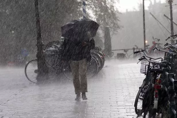
Met Éireann is warning of heavy rain over the weekend(Image: Getty Images)
Met Eireann has issued several weather warnings for counties with up to 50mm of rain forecast for parts of the country this weekend.
With Storm Bram still fresh in the memory, the country is braced for another spell of unsettled weather this weekend, with 17 counties under warnings from Met Eireann and the Met Office.
Currently, Cork and Kerry will see the worst of the weather with as much as 50mm of rain falling. Alan O’Reilly of Carlow Weather has said that Galway could see similar levels as well as the possibility of a red warning being issued.
Alan O’Reilly said: “Latest ensembles show Orange level rainfall event Saturday night into Sunday, with over 50mm in much of Kerry and some parts of West Cork and Galway. Red level rainfall of over 80mm in 24 hours possible for mountains on Cork/Kerry border.”
The first Status Yellow Rain warning covers the entire west coast from Donegal to Cork. It’s valid from 18:00 Saturday 13/12/2025 to 00:00 Monday 15/12/2025.
Met Eireann is warning of spells of heavy rain. Flood risk is increased due to high river levels and saturated ground.
Likely impacts:
• River and surface flooding
• Difficult travelling conditions
• Poor visibility
On Sunday, Cork and Kerry will be upgraded to Status Orange. There will be significant rainfall accumulations, especially on high ground, with the highest totals expected in Kerry and West Cork. It will be in effect from 03:00 Sunday 14/12/2025 to 18:00 Sunday 14/12/2025
Expected Impacts:
• Significant river and surface water flooding
• Hazardous travelling conditions
• Poor visibility
Clare, Cork, Kerry, Limerick, Donegal and Connacht will be under a yellow rain warning. It’s valid from 18:00 Saturday 13/12/2025 to 00:00 Monday 15/12/2025.
Tipperary, Waterford, and Wexford will have spells of heavy rain. Flood risk is increased due to high river levels and saturated ground. The yellow rain warning will be in effect from midnight on Sunday until 3am on Monday.
Likely impacts:
• River and surface flooding
• Difficult travelling conditions
• Poor visibility
The Met Eireann forecast for Saturday and Sunday can be seen below.
Saturday
Dry to begin today for most with hazy sunny spells but cloud and outbreaks of rain already in western parts of Connacht and Ulster will gradually spread eastwards this afternoon, turning heavier in the west and southwest later this evening. Windy in the west and northwest, with strong and gusty southerly winds and gales near the coast, with winds increasing moderate to fresh this afternoon elsewhere. Afternoon highs of 7 to 11 degrees.
Tonight
Wet and blustery tonight with widespread outbreaks of rain and drizzle. The rain will be heavy at times, particularly towards the morning in the southwest, west and northwest. Mild with lowest temperatures of 10 to 12 degrees and fresh to strong and gusty southwesterly winds.
Sunday
Continuing wet and blustery across the country on Sunday morning, with widespread outbreaks of rain, turning heavy at times, especially in the south and west. With high river levels and saturated soils, river and surface water flooding are likely, particularly in the south and west. Winds will ease in the west and northwest in the afternoon but it will remain blustery across southern and southeastern counties, especially near the coast. Highest temperatures of 11 to 13 degrees with fresh to strong and gusty southwesterly winds, easing light to moderate in the west and northwest in the afternoon.
Galway Beo’s top stories and breaking news service on WhatsApp. Click this link to receive breaking news and the latest headlines direct to your phone. We also treat our community members to special offers, promotions, and adverts from us and our partners. If you don’t like our community, you can check out any time you like. If you’re curious, you can read our Privacy Notice.