Get the free Morning Headlines email for news from our reporters across the world
Sign up to our free Morning Headlines email
Sign up to our free Morning Headlines email
Britons are set for a freezing first weekend of 2026 as Arctic winds bring a cold snap across the UK, prompting warnings of travel chaos and power cuts.
Multiple weather warnings for snow and ice issued for Friday have been extended into Monday, with as much as 40cm of snowfall possible in the highest parts of Scotland.
The Met Office has issued amber weather alerts for parts of Scotland from midday on Friday for 24 hours as forecasters warn harsh conditions pose a potential “risk to life”. It also warned that up to 20cm of snow could settle on low ground and up to 40cm on higher ground, and said disruption to road, rail and air travel was likely.
Rural communities could be cut off, with cars becoming stranded in heavy snow, and cuts to power and mobile phone services were possible, the forecaster said.
The UK Health Security Agency (UKHSA) has also issued amber cold health alerts for England until 9 January, warning that increased deaths are likely due to the freezing temperatures.
Yellow weather warnings are in place across swathes of south west England and Wales, with those on the east coast and south west extended into Monday.
On Saturday, yellow warnings remain in force in southwest England, and have also been issued along the east coast from Newcastle to Norwich. Temperatures are expected to settle at around 1C for most of the country, with the mercury dipping below freezing in parts of Scotland.
open image in gallery
A number of weather warnings are in place on Friday (Met Office)
Icy conditions are set to move westwards on Sunday, with a yellow warning covering parts of Greater Manchester, Wales, and south west England from 3pm to midday on Monday, with temperatures remaining at around 1C.
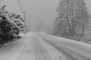
Blizzards are expected across the UK, including in areas not covered by weather warnings. Showers are predicted to become increasingly wintry on Friday evening with some snow possible in Wales. These will move further inland during the early hours of Saturday, becoming frequent and perhaps heavy at times, forecasters said.
Around 1-3cm of snow is likely to accumulate widely, with 5-8 cm possible in places like the North York Moors throughout Saturday, according to the Met Office. The snow showers will gradually become lighter and less frequent during Saturday evening, and move offshore overnight.
open image in gallery
Snow in Ashford, Kent on Friday (PA)
Snow showers are expected to push further inland across Wales, parts of northwest England, the West Midlands and southwest England during Sunday evening. Around 1 to 3cm of snow is expected to fall in many places by Monday morning, with the potential for 5 to 8cm to build up in a few locations, particularly across inland and higher parts of Wales.
Forecasters are warning people to check travel conditions, leave extra time for journeys, and prepare for power cuts in the highest ground in Scotland.
Chief forecaster, Neil Armstrong, said: “With Arctic air now covering most of the UK, very cold weather will continue through the weekend, with minus double figures overnight in places and daytime temperatures struggling to rise above 0C for some.
open image in gallery
Snowy scenes at Dalwhinnie Distillery (Dalwhinnie Distillery)
“It looks like this cold spell could last well into next week and wintry hazards will continue with more weather warnings likely. It is therefore important people keep up to date with the latest forecast and warnings and plan ahead.”
Dr Agostinho Sousa, head of extreme events and health protection at UKHSA, urged people to check on loved ones during the cold snap: “As the colder weather sets in, it is vital to check in on friends, family and neighbours that are most vulnerable.
“The forecast temperatures can have a serious impact on the health of some people, leading to increased risk of heart attacks, strokes and chest infections, particularly for individuals over the age of 65 and those with pre-existing health conditions.”
open image in gallery
Weather warnings are in place on Saturday (Met Office)
Friday
Heavy snow showers across northern and northeast Scotland today. Rain and snow clearing further south, leaving sunny skies. Some wintry showers in the west and extreme east. Otherwise fine and dry, but feeling cold in the brisk northerly wind.
Overnight
Frequent snow showers continue to affect areas exposed to the keen northerly wind, otherwise dry with long clear spells. Colder than recent nights with a hard frost developing.
Saturday
open image in gallery
Snow covers a playground and tennis courts in Warwickshire (PA)
A cold and frosty start for all on Saturday. Snow showers continue across windward coasts, further spells of prolonged snow likely across parts of northeast Scotland. Feeling very cold.
Sunday to Tuesday
Plenty of sunshine through the period, though sleet and snow showers especially affecting areas exposed to the northerly wind. Remaining cold throughout with widespread night frosts. Showers easing from Monday.