
Met Éireann has warned that a greater number of people will be at risk from Storm Floris due to large number of outdoor events over the August Bank Holiday weekend with camping higlighted by the forecaster as an area of concern.
Storm Floris was named by the UK Met Office, Met Éireann’s official storm forecasting partner, on Friday, August 1.
A Met Éireann commentary on Floris said a weather advisory has been issued with weather warnings expected to follow Saturday for the wet and unseasonably windy weather expected.
It says that a greater number of people will be exposed to these weather conditions than normal storm event because of the large number of outdoor events, camping, etc.
It outlined some of the impacts people can expect.
Dangerous travelling conditions
Fallen trees, debris and loose objects
Structural damage
Knock on impacts for outdoor events
Power outages
Wave overtopping
Localised flooding due to leaves and debris
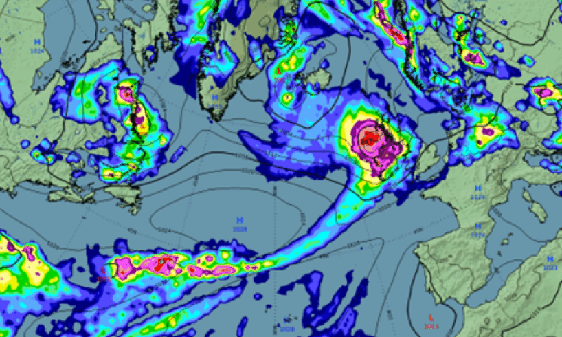
Outlining the meteorological situation on Friday, Met Éireann said unseasonably impactful weather is expected for Sunday night and into Monday as a deepening low pressure system will likely track to the northwest of Ireland, bringing a spell of heavy rain and very strong winds. MORE BELOW PHOTO.
It said an unusually strong Jet Stream for the time of year will carry the system towards Ireland through the weekend, with the storm deepening rapidly in 24 hours between Sunday and Monday).
Storm Floris is expected to track to the northwest of Ireland through Sunday night and Monday morning, before tracking over Scotland before clearing into the North Sea later in the day.
Andrew Doran-Sherlock, Met Éireann forecaster, elaborated.
“Storm Floris will bring a spell of wet and unseasonably windy weather, particularly for northwestern areas, through Sunday night and into Monday. However, there is still some uncertainty in the details so the full impacts of the system cannot yet be determined. By Saturday though, the event will be within the range of our high-resolution DINI forecasting model and warnings will be issued.
READ ALSO: Laois call for more Electric Picnic tent and sleeping bag salvage
“However, as this is a Public Holiday Weekend with a large number of outdoor events and with many people going camping, etc, and with an increased usage of temporary structures such as tents, more people will be at a greater risk of exposure than would normally be the case. And while we are in a period of neap tides, with lowest tidal ranges of this cycle expected on Sunday and Monday, strong onshore winds and high waves may cause wave overtopping in low-lying coastal areas in the northwest and west.
“Our advice would be to pay attention to the weather forecasts and warnings issued over the weekend and take them into consideration with any plans you have. And as always, please heed the advice of local authorities,” said Mr Doran-Sherlock.
Weather Advisory for Ireland
Storm Floris will bring wet & unseasonably windy weather during Sunday night and Public Holiday Monday.
Some potential impacts
• Dangerous travelling conditions
• Knock on impacts for outdoor events
• Structural damage
• Fallen trees, debris and loose objects
• Power outages
• Wave overtopping
• Localised flooding due to leaves
Warnings will be issued on Saturday 2/8/25 with further updates.
Please refer to our Meteorologist’s Commentary
https://www.met.ie/forecasts/meteorologists-commentary
Valid: 12:36 Friday 01/08/2025 to 13:00 Monday 04/08/2025
Issued: 12:37 Friday 01/08/2025
ADVERTISEMENT – CONTINUE READING BELOW
ADVERTISEMENT – CONTINUE READING BELOW
ADVERTISEMENT – CONTINUE READING BELOW
ADVERTISEMENT – CONTINUE READING BELOW
ADVERTISEMENT – CONTINUE READING BELOW
ADVERTISEMENT – CONTINUE READING BELOW
ADVERTISEMENT – CONTINUE READING BELOW
ADVERTISEMENT – CONTINUE READING BELOW
ADVERTISEMENT – CONTINUE READING BELOW