

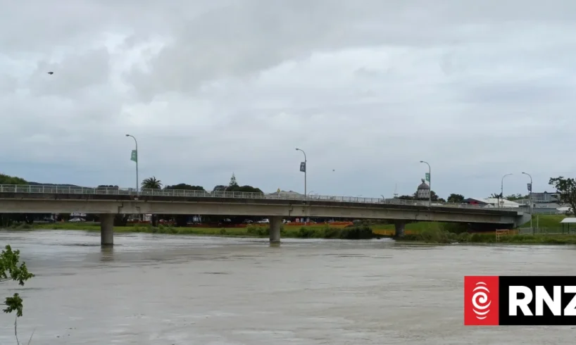
Wairoa District Council says floodwaters in the Hawke’s Bay town are beginning to recede.
A state of emergency was declared on Thursday night with an Orange heavy rain warning in place in the area.
People in low lying or flood prone areas were told to leave if they felt unsafe.
If you’ve been affected, or have pics or videos email: [email protected]’
An evacuation centre at Taihoa Marae had been opened but is now closing.
One remains open at Wairoa War Memorial Hall.
The council encouraged people to avoid floodwaters, and crews are assessing affected areas.
Late last night mayor Craig Little declared a local State of Emergency for the district.
Mayor Craig Little
Nick Monro
The declaration at 11pm followed what Wairoa District Council called “significant flooding across the district, with rising river levels affecting homes, businesses, farms, roads and essential services.”
Some communities have become isolated and “a number of residents have already been evacuated from affected areas to ensure their safety,” the council said in a Facebook post.
“Declaring a State of Emergency allows emergency services and response agencies to work together quickly and effectively to protect people, coordinate resources, and support our communities as the situation continues to develop.
“If you live in a low-lying or flood-prone area and are concerned for your safety, please do not wait.”
On Friday, more than 600 homes are without power in the east of the North Island after heavy rain in the area.
Three hundred Wairoa properties are affected, with lines company Firstlight Network listing trees on powerlines and wires down in the town as the causes for the outages.
A further 200 properties are without power in Gisborne and about 170 on the East Cape near Uawa Tolaga Bay.
State Highway 2 between Napier and Wairoa is shut due to flooding.
Nearby State Highway 58 north of Wairoa between Frasertown and Tuai is also closed.
Further north State Highway 2 connecting Gisborne city and Opotiki is shut between Te Karaka (Cliff Road) and Whatatutu Road.
Second evacutation centre opens
At 12.10am, the council said on Facebook that Taihoa Marae, on the north side of the river, had been opened as an additional evacuation centre for residents.
The other evacuation centre is Wairoa War Memorial Hall.
“If you are in a low-lying or flood-prone area and are concerned for your safety, please do not wait. Leave early while it is safe to do so,” the council’s post said.
“If you know someone who may need assistance, please check in on them if it is safe to do so.
“Emergency services and response agencies will be heading out to assist with evacuations in flooded streets in Wairoa.
“Please continue to monitor conditions throughout the night. Please avoid unnecessary travel, follow all road closures, and never drive through floodwater.”
Declaration follows alerts and warnings
Earlier on Thursday night, Wairoa residents received an emergency alert as floodwaters began to rise in low-lying areas.
People between Outram and Grant Streets, and Kopu Road and Apatu Street were advised to leave immediately, taking essential items and pets.
The council had said floodwater was beginning to come across Kopu Rd, and the road was closed in the Sturdee St area.
It comes amid an orange heavy rain warning for the ranges of Hawke’s Bay, north of Napier, that is in place until 9am on Friday.
MetService said: “Expect 100 to 130mm of rain on top of what has already fallen. Peak rates of 10 to 20 mmh [an hour] expected today.”
The council had previously warned residents to be ready to leave at a moment’s notice – concerned about the lower catchment of the Wairoa River.
It said police will be door knocking properties in the area to ensure residents are aware of the changing conditions and to assist anyone who may need to evacuate.
Modelling showed overnight river risk
Following discussions with its flood modellers on Thursday evening, the council said there are increasing concerns that river levels could rise significantly overnight.
Its concern was the lower catchment of the Wairoa River.
“While the Wairoa River mouth is open, outgoing water and rising flow is competing against large 3m-4m swells coming in from the coast,” it said.
“More water is also expected to flow into the Wairoa River from the upper catchments, with further heavy rain forecast overnight.”
High tide was expected around 12.47am on Friday, with intense periods of rain until 3am.
Mayor Little said the emergency operations centre has been stood up and will be monitoring the situation through the night.
A heavy rain warning is in place until tomorrow morning for the ranges of Hawke’s Bay north of Napier.