

It has already battered several parts of Ireland
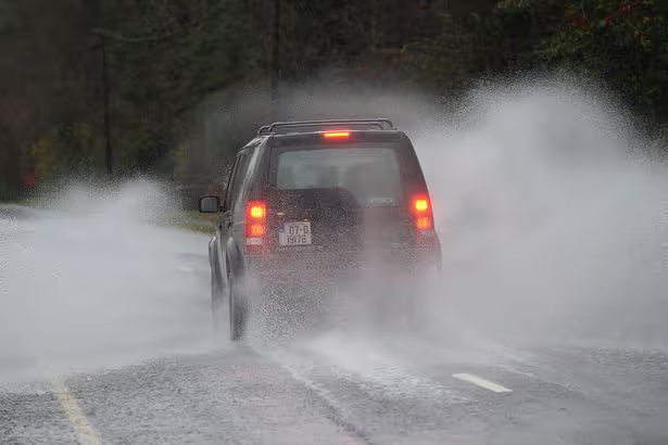
A car drives on a flooded road(Image: Artur Widak/NurPhoto)
Met Eireann has raised the alarm after new forecasts showed Storm Chandra bringing heavier rain, stronger winds and a higher flood risk than first expected.
What started as a Status Yellow wind warning for seven counties has now been upgraded to cover every single county in Ireland – with the national forecaster warning that the worsening system could cause significant disruption today.
This alert, in place until 11pm, warns: “Winds associated with Storm Chandra will be very strong and gusty particularly on coasts and in exposed areas. Possible impacts include fallen trees and loose debris, wave overtoppping and hazardous travel conditions.”
A separate Status Yellow rain warning is in place for Carlow, Kilkenny, Louth, Wexford, Wicklow and Waterford, also until 11pm, and states: “Bands of rain associated with Storm Chandra will be heavy and persistent.
“Rain falling on already saturated ground will lead to the following: Possible impacts include localised flooding, river flooding and difficult travel conditions.”
Storm Chandra, named by the UK Met Office, is set to track northwards across the country, bringing persistent and at times intense rainfall, accompanied by strong and gusty winds, particularly along coastal and exposed areas.
Met Eireann meteorologist Rebecca Cantwell said the developing situation is of growing concern due to the combined effects of wind and rain falling on already saturated ground, reports the Irish Mirror.
She said: “Storm Chandra is a low-pressure system that will track northwards over the country Monday night and Tuesday, bringing with it rather wet and windy conditions. It will bring heavy spells of rain with strong winds, especially along the coast.
“It will slowly clear northwards later on Tuesday.
“Given the unsettled spell of weather we’ve experienced over the last while, this rain will fall on already saturated ground, combined with the fact that many rivers are approaching or exceeding bank-full conditions, and so we are expecting localised flooding and river flooding as a result.
“We have issued yellow level rainfall warnings for southeastern counties where the rain is expected to have the greatest impacts. This rain will also be accompanied by strong and gusty winds, affecting especially coastal areas, and a yellow wind warning has been issued for the entire country.
“The compound effect of the wind and rain will make for some difficult travelling conditions during the validity period of the warnings and so we would urge people to keep that in mind when out and about.
“The winds will be strongest near coasts and exposed areas with wave overtopping possible and so we echo the well-known advice of the Irish Coast Guard: ‘Stay Back, Stay High, Stay Dry’. In summary, stay back from rivers, lakes and the coasts and avoid flooded roads, following the latest guidance from your local authority and road authorities.”
The national forecaster has warned this is a multi-hazard event and has issued the following advice on how to stay safe during Storm Chandra.
Stay up-to date with the forecast and the warnings for your county on met.ie, the Met Éireann app or Met Éireann socials (@meteireann).Check in with your local authority and emergency management stakeholders (Irish Coast Guards, Gardaí, etc) via their websites and social channels on road closures, flooding updates, and community alerts.Allow for disruption during Tuesday morning and evening commutes.Plan extra travel time and reduce speed.Expect surface water, debris and poor visibility onCheck in with neighbours, older people or anyone who may need assistance in case conditions worsen.Coastal areas are likely to experience wave overtopping especially in low-lying locations.Keep away from coastal edges, harbours, piers and low-lying promenades during high tide. The Irish Coast Guard advice remains: ‘Stay Back, Stay High, Stay Dry.’Stay back from riverbanks, streams and canals – water levels may rise quickly.Keep children and pets away from waterways and flooded areas.Don’t try to walk, cycle or drive through flooded areas – turn back and use another route.Remember: As little as 150mm of fast-flowing water can knock you off your feet and 300mm of fast-flowing water can move most cars off the road.Ensure your mobile is phone is fully charged to enable communication in advance of the event and keep local emergency numbers in your phone.Take care on exposed roads and bridges.Watch for fallen branches and debris.Allow extra time for your trip and if you are driving a high sided vehicle, try to anticipate exposed sections of roadway where winds will be stronger.Secure loose outdoor items ahead of strengthening winds.ESB Networks is highlighting the dangers posed by fallen live wires and is advising the public and the emergency services to stay away from these fallen cables and to report such cases to it immediately. ESB Emergency Services can be contacted at 1800 372 999.The public can monitor PowerCheck.ie in regard to power restoration times.Keep a small amount of food, medical and water supplies in case it’s dangerous to step out of the home.Uisce Éireann customers can check the website and social media channels for updates and to get in touch with any issues or concerns via their 24/7 customer care centre at 1800 278 278. The public can also sign up online to their free text alert system to get regular updates about their local supplies – see water.ie.”’Be Winter Ready’: Follow recommendations before, during and after the event on gov.ie – Be Winter Ready.
Galway Beo’s top stories and breaking news service on WhatsApp.
Click this link to receive breaking news and the latest headlines direct to your phone.
We also treat our community members to special offers, promotions, and adverts from us and our partners.
If you don’t like our community, you can check out any time you like.
If you’re curious, you can read our Privacy Notice.