

Amber Valley Borough Council has been working on a new housing blueprint for years
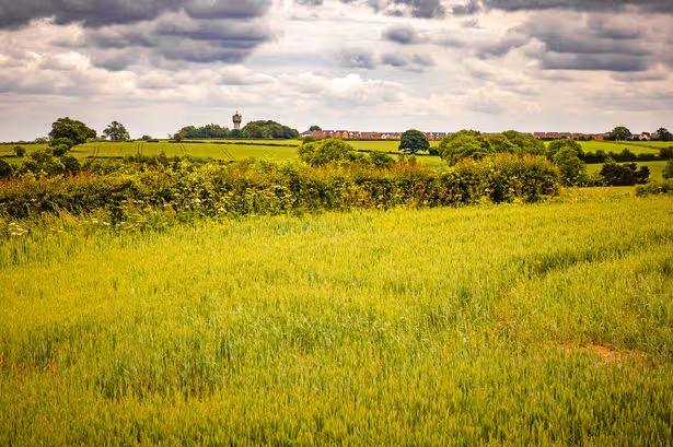
A huge expanse of land west of Mackworth towards Kirk Langley has been earmarked for 2,000 houses in Amber Valley Borough Council’s Local Plan(Image: Derby Telegraph)
An area of Derbyshire has finally sealed a housing blueprint after 15 years without one, earmarking 7,700 homes and key changes on affordable housing.
Amber Valley Borough Council has been working on cementing a legally mandated housing blueprint for more than a decade without one.
During that time, the council has been named and shamed and been handed significant warnings over its lack of an adopted plan, with the last one fading out of date in 2011.
Now the council has sealed its new Local Plan, which outlines areas where it has earmarked housing land for a total of 7,656 homes to be built by 2040.
On top of this would sit 193 acres of new business and employment space – enough to cover nearly 100 football pitches.
The single largest housing site – rebadged an “area for future growth” – in the adopted plan is that of 2,000 homes off Brun Lane to form a western extension to the Derby suburb of Mackworth, bridging the city towards Kirk Langley.
This would include a primary school, secondary school and shops and services.
At the Local Plan public hearings in late 2024, Government inspectors – who have now signed off on the overall document – were told that the landowners of the fields in question off Brun Lane had no intention of giving up their land for a 2,000-home estate.
The borough council’s representative, Matthew Bowers, said the authority was willing to compulsory purchase – seize the land – as a “last resort”.
Amber Valley’s now adopted Local Plan says a masterplan for the site will be agreed and will include a new “strategic highway link to the west of Derby”.
It says it does not rely heavily upon this site to meet its targets and does not envisage homes coming forward there until the back end of the 2040 plan, with an aim to have 1,320 homes built there by that point.
The proposed plan for up to 2,000 homes in Brun Lane, Mackworth(Image: Amber Valley Borough Council)
Meanwhile, the council has also earmarked a 300-home and approaching half of its overall employment land (74 acres) at land known as Cinderhill, surrounding the former toxic tar pits north of Denby Bottles and east of Belper, bordering the A38.
Harworth and Pegasus Group had plans for 300 homes and 74 acres of business space on that site recommended for approval in the summer of 2024, but that was deferred by councillors, with the application still pending with the council.
Approval of that plan would see the highly contaminated toxic tar pits left as they are and not remediated and regenerated.
The developers had said the scheme represents a £455 million investment in the area during construction and will create 1,500 new jobs on site.
They say that the project will include 60 affordable homes (20 per cent).
Previous plans for 3,000 homes on the site had included a new junction off the A38 and the most recent scrapped scheme in 2019 had included 1,200 homes and 12 acres of employment space.
It had previously been stated by the developers that the construction of homes would help pay for the remediation of the tar pits, which would otherwise be too expensive.
The Environment Agency has said it is “disappointed” that the tar pit remediation has been dropped in this scheme.
There are 13 further housing sites earmarked alongside Brun Lane and Cinderhill, ranging from 10 homes to 180.
These are:
Aldreds Lane, Heanor – 180Alderwasley Mills, Ambergate – 140Birchwood Lane, Somercotes – 75Long Close, Ripley – 70Outseats Farm, Alfreton – 60Ashbourne Road, Kirk Langley – 53Whysall Street, Heanor – 42The Common, Crich – 25Sleetmoor Lane, Somercotes – 25Crich Road, Fritchley – 17Leafy Lane, Heanor – 15Brook Street, Heage – 14Cinder Road, Somercotes – 10
Smaller “economic growth sites” have been earmarked at Charity Road, Riddings (two acres); Cotes Park Lane East, Somercotes (30 acres); Hockley Way, Somercotes (three acres); Lily Street Farm, Swanwick (26 acres); and Shipley Lakeside – the former American Adventure site (three acres).
Meanwhile, the new plan outlines key changes to how affordable housing will be distributed and funded by developers around the borough.
Each ward in Amber Valley has been assigned a development land “value”, either high, medium or low, based on the profit developers can stand to make from building in each area.
If an area has a higher development land value, it will be required to provide a higher proportion of affordable housing.
High-value sites will have to provide 40 per cent affordable housing, medium-value 30 per cent, low-value 20 per cent and small brownfield sites in the low-value zone of between 10-19 properties will need to provide 10 per cent.
Alfreton, Heanor and Ripley – three of the borough’s four towns and those with the largest deprivation issues and highest public transportation links – have all been placed in the low value category, while Belper is in the medium banding.
This will see Alfreton, Heanor and Ripley get fewer affordable homes than had previously been required by the council – 30 per cent.
Belper is joined by Duffield, Denby, Holbrook and Kilburn in the medium band.
The only high-value development areas are the significantly rural wards on the western side of the borough, ranging from Crich to Idridgehay, to Mugginton, Kirk Langley, Mackworth, Kedleston and Quarndon on the outskirts of Derby.
Ironville, Riddings, Somercotes, Swanwick, Aldercar, Langley Mill, Horsley, Mapperley, Shipley, Smalley and Codnor are all in the low-value banding.
The council has also earmarked a replacement non-Green Belt plot for a currently unauthorised Traveller site in High Holborn Road, Codnor, with a capacity for two pitches.