
Place names hold a certain fascination, and perhaps nowhere more so than in the districts which comprise Coventry.
Given the city’s considerable age, many of Coventry’s neighbourhoods have histories stretching back centuries, but what exactly are their origins and meanings?
Have you ever pondered why Stivichall bears that name (or Styvechale), or wondered about the etymology of Cheylesmore?
Read more: I visited the supermarket with a difference as people in Coventry ‘skip meals to afford heating’
Read more: Ten more CCTV cameras could be installed on Coventry city centre’s ‘red route’
Coventry boasts 40 suburbs, several with particularly distinctive names.
Lately, we’ve been looking at the history of the names of suburbs in Coventry.
We investigated their origins, traced their evolution and uncovered one or two interesting historical details.
The piece proved extremely popular, prompting us to revisit the topic.
Given the sheer number of areas, we’ve divided the content into sections.
In this latest instalment of our series, we examine Allesley, Ball Hill, Bell Green, Cheylesmore, Earlsdon and Foleshill.
Read more: The stories behind the names of Coventry suburbs from Binley to Willenhall
Read more: The fascinating stories behind Coventry suburb names including Styvechale and Wyken
Allesley
Allesley village(Image: Birmingham Mail)
Allesley stands out in Coventry as the sole village situated within the city limits.
It retains that delightful village character while being mere minutes from the city centre along Holyhead Road (traffic permitting).
The village possesses an extensive history, reaching back to the Norman period.
Its name is believed to derive from Aelle’s clearing or wood.
The identity of Aelle himself may remain forever unknown.
Historical records indicate that between 1129 and 1158, it formed part of the estates belonging to Ranulf, Earl of Chester. At that time, the area could claim to sit within what was once the vast Forest of Arden, which covered a significant portion of Warwickshire.
The village’s main road was formerly a well-travelled coaching route.
The village is situated between the River Sherbourne and Pickford Brook.
Ball Hill
Ball Hill is a name that sparks the imagination – perhaps evoking thoughts of sporting contests or grand society gatherings.
In reality, the area, which does feature an actual hill within its landscape, is believed to take its name from the Old Ball Hotel, which still stands at the summit.
Interestingly, the area bore an even more unusual name in the not-too-distant past – Stoke Knob – as it was commonly known prior to the early 20th century.
It was once predominantly residential, though the majority of its properties have since been converted into commercial premises over the years.
Delving further back into history, the area boasts a remarkable historical claim to fame.
In 1385, King Richard II descended upon Coventry after two of his favourites, Thomas Mowbray, Duke of Norfolk, and Henry Bolingbroke, Duke of Hereford, became embroiled in a bitter dispute.
Having levelled grave accusations against one another, including charges of treason and murder, the quarrel was settled by way of a trial by combat to the death.
It was King Richard himself who selected the battleground – open land on Gosford Green – and it is said he set up the royal encampment on elevated ground overlooking the very spot where the Old Ball now stands. In the end, the duel to the death was called off by the King, who chose to exile them both instead.
Bolingbroke certainly lived to fight another day, making his way back from exile to depose Richard and claim the throne as King Henry IV.
Bell Green
Much like many suburbs which now makeup Coventry, Bell Green, currently a sub-district of Foleshill, was formerly a village situated roughly three miles north of Coventry.
The area received its name in 1725, and it’s thought this came about because church bells were manufactured on the village green.
As time went on, the village and its surroundings became somewhat of a hub for both drinking establishments and places of worship.
The Bell Inn is first recorded in 1764, the Green Man in 1793 and the Rose and Crown in 1838.
During the mid-19th century, a large number of residents worked as silk ribbon weavers, though there were also coal miners and even a drinking establishment named the Miners’ Arms.
Bell Green returned to Warwickshire in 1842 and didn’t become part of Coventry again until 1928-1932.
Following 1930, Lord Nuffield established the Morris works, and the development of Sewall Highway in 1932 triggered significant residential construction.
Cheylesmore
Among Coventry’s suburbs boasting an extensive past – particularly as a royal hunting estate – the origins of Cheylesmore’s name are believed to stem from the old English terms ‘cielde’ meaning well or spring and ‘mor’ meaning moor.
The area’s heritage is thoroughly recorded by the Coventry Society and provides intriguing information as outlined below. The estate originally belonged to Leofric and Godiva before eventually falling under the control of the earls of Chester.
In 1232 ownership transferred to the Earl of Arundel, who constructed Cheylesmore Manor House in 1237, complete with a moat and parkland, to supersede the obsolete Coventry Castle.
By 1330 the estate had reverted to Queen Isabella, and following her death it was inherited by her grandson Edward of Woodstock, known as the Black Prince, who stopped at the park while travelling to London after his grandmother passed away. Edward is believed to have frequently hunted deer within Cheylesmore Park.
Following Edward’s death, the estate transferred to his son King Richard II, who redirected the city wall to encompass the manor house.
During this period the park covered 436 acres, comprising pasture, woodland and moorland, home to deer and various game.
Throughout subsequent centuries the estate and park remained unified under Crown ownership, though leased to different parties, including the corporation.
Royal ownership concluded in 1819 when the Prince of Wales sold the estate to the Marquis of Hertford, and in 1871 it passed to HW Eaton, Lord Cheylesmore.
From then onwards the park was progressively sold for development, starting with land closest to the city centre in Parkside, which became the location for prominent companies including Armstrong Siddeley Motors, Maudsley and Swift, and subsequently Rolls Royce. Land development pushed south towards the Quinton area during the 1920s and continued further south in the post-war period. The land surrounding Quinton Pool is the sole remaining reminder of the extensive Royal hunting park of Cheylesmore.
Earlsdon
The origin of Earlsdon’s name remains somewhat mysterious, but fundamentally it was an entire community constructed from nothing in the mid-19th century to accommodate workers in Coventry’s rapidly expanding watch-making sector.
Farmland outside the then city boundary, belonging to John Moore, was purchased by Coventry Freehold Land Society in 1851.
The suburb developed around the original farmhouse and by 1853 the heart of what is now Earlsdon had been formed.
The watch-making sector subsequently declined but Earlsdon kept growing and flourishing, becoming one of Coventry’s most sought-after suburbs – a position it maintains today.
It was absorbed into the city in 1890.
By 1918, it had been fully developed to its current form and has preserved much of its original character.
The watch-making heritage is represented by the clock on the roundabout at the bottom of the high street, where Earlsdon Avenue North and South meet.
The area has a captivating history depicted by David Fry in his book Earlsdon and Chapelfields Explored, written in collaboration with fellow local history enthusiast Albert Smith.
It reveals how the area was initially populated in the mid-19th century by Puritans, strongly opposed to the evils of drink. The small non-conformist community of Puritan residents opposed pubs and even chip shops in the area.
In a remarkable account, the book reveals how M&B brewery officials, aware that residents would reject a pub in their neighbourhood, established Coventry’s largest off licence – Clarence Stores in Earlsdon Avenue – only to transform it into a pub years later as Clarence Inn in 1928.
Such was the locals’ concern about the dangers of alcohol that Coventry’s biggest coffee house, Earlsdon Coffee Tavern, was established in Earlsdon Street in 1899 to tempt would-be pub-goers away.
It survived just three years before closing and subsequently becoming the Albany Club.
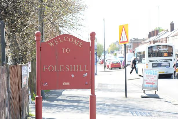
Foleshill
Foleshill is another of Coventry’s suburbs with an extensive history.
In 1086 it was recorded with Ansty as a single estate of nine hides, and the area of Exhall may also have been part of it.
Along with Ansty, it formed an estate previously held by Godiva.
As with Godiva’s other estates, the overlordship transferred to the earls of Chester.
Its name is widely accepted to mean ‘hill of the folk or people’.
‘The Folk’s Hill’ appears to have been a meeting place for people.
It’s believed that the original settlement there was particularly significant, with limited development surrounding it.
Historically the area was larger, encompassing territory that stretched as far as Bedworth and maintaining its own council (Foleshill Rural District Council) until it was incorporated into Coventry in 1932. From the latter half of the 16th century, coal mines began to emerge across the region, particularly in its northern reaches, while weaving became a widespread cottage industry.
The area was once notorious for its poverty and disorder, to such an extent that it was brought to the attention of several parliamentary committees in the early 19th century.
In an 1840 report, one witness described “the whole appearance of the single-hand weaving districts, and of their inhabitants” as “one of rudeness, poverty, and depression” and that “the lawlessness of the district” had “of late years much increased”.
The area was equally notorious for ‘ignorance, immorality, and drunkenness’, with it being noted that “the magistrates of Coventry well know that when a desperate case is brought before them it is generally from this neighbourhood”.