

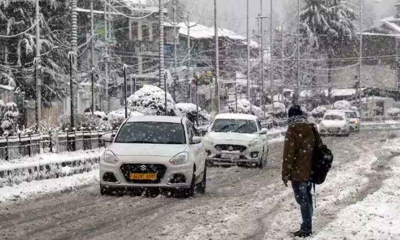
Jammu and Kashmir is witnessing its first significant snowfall of the season, turning the region’s hills and plains into a picturesque winter landscape. Popular hill stations like Gulmarg, Sonamarg, and Pahalgam have received several inches of snow, while the plains, including Srinagar, are also covered in a thick white blanket, bringing relief after a long dry spell.
Snowfall in hills and higher reaches
Some areas, including Zojila Pass and surrounding locations, recorded massive snowfall, with temperatures ranging from as low as -27 degree celsius to -4 degree celsius.
Add Zee News as a Preferred Source
Snowfall in plains
Srinagar and other plains have seen meadows and rooftops covered in a white blanket, with temperatures dropping below freezing.
The heavy snowfall has led to the closure of major highways and affected flight operations at Srinagar Airport. At the same time, the fresh snow has boosted local tourism, with high demand for winter sports like skiing and snowboarding in Gulmarg.
The India Meteorological Department (IMD) has predicted continued moderate to heavy snowfall across both North and South Kashmir due to back-to-back western disturbances.
Impact on flights and traffic
Flight operations at Srinagar International Airport have been significantly affected. All major airline carriers have issued warnings of delays and possible cancellations due to low visibility and snow accumulation on the runway. Travelers are urged to check their flight status before heading to the airport.
Traffic on the Jammu–Srinagar National Highway (NH-44) remains suspended due to slippery road conditions at stretches like Nashri, Ramban, and Banihal. The road is also closed for all traffic at Peer Ki Gali due to fresh snowfall.
The Srinagar–Leh Highway (NH-1D) is blocked at Zojila Pass, with traffic movement suspended until further notice. Similarly, the Kishtwar–Sinthan–Anantnag Road (NH-244) remains closed due to heavy snow accumulation.
Traffic advisory
Authorities have issued advisories urging commuters to contact the Jammu and Kashmir Traffic Control Units for the latest updates on road clearance before starting any journey.
The IMD has warned that precipitation will peak through late afternoon on January 23, with another moderate western disturbance expected to hit on the night of January 26. Moderate to heavy snowfall is predicted for higher reaches, with accumulation reaching up to three feet in some areas.
Preceding windstorm causes widespread damage
On the evening of January 22, exceptionally strong gusty winds associated with a powerful western disturbance swept across Jammu and Kashmir, causing widespread destruction.
Before the snowfall, Kashmir witnessed a high-intensity windstorm that ripped off rooftops of several residential and commercial buildings across the Valley. Areas significantly affected included Tangmarg, Khag, Gulab Daji, Bernar, and Karan Nagar in Srinagar, where a collapsed house roof disrupted traffic. North Kashmir, Anantnag, Pulwama (including Shadimarg), and Shopian districts reported shattered window panes and uprooted tin sheets. Parts of Poonch recorded wind speeds of up to 80 km/h, causing extensive roof damage.
Over 80 percent of the Kashmir Valley was plunged into darkness for hours. Srinagar International Airport recorded wind gusts of up to 83 km/h, contributing to severe flight disruptions. The winds also triggered forest fires at multiple locations across the region.