

Shafaq News
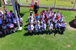
On a morning approximately ten days ago, parents in the
Shoraw neighborhood of Kirkuk, a disputed oil-rich province in northern Iraq
claimed by both the federal government in Baghdad and the Kurdistan Regional
Government, began receiving alarming messages: a local education institution
—Othman Faraj School— had been renamed on Google Maps to “Iranian
Consulate.”
By the time administrators confirmed the label was false,
the damage was done. Parents rushed to collect their children, phones flooded
the school’s front desk, and a neighborhood was gripped by fear it could not
immediately explain or disprove.
In a separate case, locals told Shafaq News that a student
renamed his own school on the same platform to “American Military
Base” —an act described as a prank that nonetheless generated identical
anxiety.
Together, the two cases have exposed what digital safety
specialists, security analysts, and technology experts describe as a critical
and unaddressed vulnerability: the open-editing architecture of major mapping
platforms creates conditions for rapid, low-effort misinformation with
immediate physical consequences in conflict-affected environments.
Fear on the Ground
“As a parent, it was very unsettling,” said Umm
Ahmad, a mother of a Grade 6 student at Othman Faraj School, whose account was
posted publicly on social media. “We suddenly started hearing that our
children’s school was labeled on Google Maps as the Iranian Consulate, and
everything changed almost immediately. People in the neighborhood became
anxious, and there were safety concerns, especially given the tensions in the
region.”
She described a school administration overwhelmed by a
crisis not of its making. Some parents rushed to collect their children early,
while others kept calling the administration to understand what was happening.
The staff tried to reassure families, but were also visibly distressed. Her
account was consistent with the broader pattern of panic documented by Shafaq
News in the days following the incident.
The fear, she said, was specific: that a false digital label
could attract real-world attention to a building full of children. “When
something like that appears publicly, especially in a sensitive place like
Kirkuk, it creates real fear for families.”
Mohammad Musa, a Kirkuk resident, told Shafaq News the
phenomenon had moved beyond any single incident. The appearance of military
labels near homes and schools generates panic regardless of whether the
underlying claim is verifiable. “Just seeing the name of an armed group on
a map near your house can cause real fear, especially under current
circumstances,” he said.
Militarily Irrelevant, Socially Damaging
Security and technical experts consulted by Shafaq News were
consistent on one point: the manipulated labels carry no meaningful military
intelligence value. Saif Ra’ad, a security analyst, said the edits appeared to
serve comedic rather than operational purposes. “The information is false
and cannot be used as targets,” he told Shafaq News, explaining that
military institutions operate from verified intelligence supported by aerial
and satellite reconnaissance —not open internet data.
Ra’ad added that content published on mapping applications
is passed through a comprehensive intelligence filter before any operational
consideration, making direct reliance on such data “functionally impossible for
serious actors.”
Technology specialist Ihab Annan reached a similar
conclusion from a different angle. State-level security institutions, he told
Shafaq News, do not rely on public mapping applications because they possess
proprietary systems of considerably greater precision, typically
satellite-linked. He noted that some open-source data may be cross-referenced
against verified intelligence, but the primary infrastructure is entirely
separate from consumer platforms.
Annan observed, however, that complete avoidance of digital
tracking is nearly impossible given the degree to which modern devices are
integrated with platforms such as Google, whose algorithms continuously collect
and process location data.
Read more: Fake war, real impact: How AI-generated content is reshaping public perception in Iraq
A Failure of Digital Infrastructure
Dr. Mohammad Awada, founder and CEO of AwadaTech, a
Lebanon-based technology firm specializing in AI solutions, smart systems, and
school management platforms, told Shafaq News that the open-editing model used
by platforms such as Google Maps introduces elevated risks in conflict-affected
environments that do not exist to the same degree in stable contexts.
“In conflict zones, digital information is not neutral
—it can shape behavior on the ground,” Dr. Awada said. In stable settings,
user-generated edits can improve platform accuracy. In politically volatile
areas, the same openness becomes a vector for misinformation.
The risks he identified include low verification thresholds
that allow false labels to propagate rapidly, the deliberate misidentification
of locations— what he termed the weaponization of digital geography— and a
moderation time lag that is particularly consequential in fast-moving security
situations.
The educational consequences, Dr. Awada said, are immediate
and multi-layered. When a school is falsely labeled as a military or diplomatic
installation, even briefly, students experience fear and confusion, parents
withdraw their children, attendance drops, and administrative staff are forced
to manage a crisis they did not create. “This is a failure of the digital
ecosystem to protect physical learning spaces.”
On the question of accountability, Dr. Awada said
responsibility is shared but asymmetrical. Platforms such as Google bear
primary responsibility because they control data verification systems,
moderation speed, and escalation mechanisms. In high-risk regions, he argued,
platforms should apply stricter validation layers for sensitive sites,
including schools, hospitals, and government facilities.
National regulators carry secondary responsibility and can
define legal thresholds and establish reporting channels, but their influence
depends on enforcement capacity and meaningful cooperation from global
technology companies. Educational institutions themselves are reactive actors
with no ability to control platform infrastructure.
“Digital infrastructure is now deeply embedded in
physical safety, but governance has not kept pace.”
Read more: AI reshapes Iran-Israel-US conflict as cyber warfare expands
A Legal Gray Zone —With Exceptions
According to Shafaq News’s review of Iraqi legislation,
falsely labeling a civilian location as a military or security installation on
a public digital platform may constitute a punishable offense under existing
Iraqi law. In the absence of a comprehensive cybercrime statute —a draft
Information Crimes Law remains pending— Iraqi authorities have applied Iraqi
Penal Code No. 111 of 1969, specifically provisions in Article 433 and related
sections against spreading false information and threatening public order, to
cases involving digital misinformation.
Misleading information that links a civilian area to
military or security targets may additionally be deemed an offense affecting
internal or external state security under the same code. Shafaq News’s review
further identified Anti-Terrorism Law No. 13 of 2005 as a potential legal
avenue if false labeling is deemed to have caused public panic or facilitated a
criminal act —though application at that threshold would require prosecutorial
determination.
The legal exposure is more clearly defined in the Kurdistan
Region of Iraq, where the Kirkuk incident occurred. Kurdistan Region Law No. 6
of 2008 explicitly criminalizes the use of the internet to spread false
information, with penalties ranging from six months to five years in
imprisonment —providing a more specific legal framework than exists at the
federal level.
An Institutional Response — Partial but on Record
Raoof Mohyiddin, head of the Supervision Unit at the Kirkuk
Education Directorate, confirmed in a press brief that educational authorities
notified both the provincial police command and the Iraqi National Intelligence
Service of the incident to track down those responsible. “Strict legal
measures will be taken against those involved in this act, which endangered the
lives of hundreds of students and spread terror among families,” Mohyiddin
said.
The Kirkuk Education Directorate followed the security
referral with a formal directive to all school principals across the province,
instructing them to monitor their institutions’ names on search engines and
digital mapping platforms “on a continuous and periodic basis,” and to report
any manipulation immediately to prevent recurrence.
The response, while meaningful at the provincial level,
exposed the boundaries of institutional reach. The Communications and Media
Commission, Iraq’s principal federal body for overseeing digital and media
communications, issued no public statement, no regulatory guidance, and
received no documented complaints in connection with the incidents, according
to a review of its official website and social media accounts. The gap between
a provincial education authority acting and a national digital regulator remaining
silent defined the limits of Iraq’s institutional response.
Shafaq News submitted a written press inquiry to Google
seeking responses to three questions: whether the platform maintains a
dedicated moderation mechanism for location edits that falsely designate
civilian sites as military or security installations in conflict zones; what
its standard response time is for reversing such edits when reported; and
whether it applies additional oversight to user-submitted location edits in
regions experiencing active armed conflict. Google did not respond to the
inquiry by the time of publication.
There is no comprehensive global framework specifically
addressing geospatial misinformation in conflict zones. General platform
content moderation policies exist, but are not tailored to geographic
sensitivity. Existing digital safety frameworks, including UNESCO guidelines on
risk environments, do not address mapping systems at the operational level
required. Crisis-response mechanisms, where they exist, remain ad hoc rather
than institutionalized, according to Shafaq News’s review.
A Temporary Label, a Permanent Question
The labels at Othman Faraj School and the unnamed school
have since been corrected on the platform. No arrests have been publicly
announced in connection with either incident, despite the referral to police
and intelligence services, and no federal regulatory action has been announced.
The national authorities did not even issue public guidance to citizens on how
to report or respond to similar manipulations.
A temporary mislabel in a conflict setting is not a minor
technical glitch. It is, as Dr. Awada framed it, “a potential security incident
with educational, social, and institutional consequences,” and as the Kirkuk
case demonstrates, the systems designed to prevent or correct it have yet to
catch up.
Written and edited by Shafaq News staff.